Carn Mor Dearg, CMD Arête and Ben Nevis
A challenging mountain outing for more experienced walkers, this amazing horseshoe route takes in the impressive and narrow CMD Arête on your route to the summit of Ben Nevis. A classic Scottish mountain walking adventure.
NOTE – the Allt a’ Mhuilinn river needs to be crossed at the end of this walk, so check river levels and recent rainfall – the crossing will be more difficult when water levels are high and in spate.
“CMD” is Càrn Mòr Dearg – Scottish Gaelic for ‘Great Red Cairn’. An “Arête” is a sharp bridge between two or more glacial hollows (“corries”)
Walk Summary:
- Distance: 11 miles / 18km
- Ascent: 1500m
- Time: 9-10 hours
- Start Point: North Face Car Park, Torlundy
- Grid Ref: NN 144 763
Maps:
- Ordnance Survey: Explorer 392
- Harvey Maps: British Mountain Map – Ben Nevis & Glen Coe
Getting to the start:
The North Face car park – where this walk begins – is situated in Torlundy, a small community on the outskirts of Fort William, accessed via the A82. Buses access Torlundy from Fort William bus station (request stop on route to Spean Bridge). You can find up to date bus timetables on the Shiel Buses website.
Read our Getting to Ben Nevis guide for more options, including travelling by train (a scenic and eco-friendly option!) and coach.
If you’re driving, head to the North Face pay and display car park (so called because it’s where climbers can access the cliffs of the north face of Ben Nevis – it’s not sponsored by the clothing brand!) For sat nav, you’re heading to:
The North Face Car Park, Torlundy, Fort William PH33 6SW

Starting the walk
1. Leave the car park area by way of a well-engineered trail waymarked the North Face trail.
This ascends and zig zags through the trees of the large Leanachan Forest area on the lower slopes of the Ben Nevis massif and its connecting mountain ranges.
Leanachan Forest sits on the lower slopes of Ben Nevis and forms part of the mountain’s approach landscape. Managed for forestry and recreation, it’s a mix of commercial woodland and quieter trails, offering shelter, wildlife habitat, and an important buffer between Fort William and the open hill.
2. Just below the 300m contour, exit out of the forest boundary and on to open ground, with the views of Ben Nevis’ dramatic north face cliffs ahead of you.
The trail now follows the lively Allt a’ Mhuilinn (‘mill stream’) on your right for approximately 800m, until a less distinct path departs from the trail at the 350m contour to ascend the vegetated lower slopes of Carn Dearg Meadhonach – the first summit to aim towards.
3. You now have a steady 3.2km ascent towards this summit – heading generally south-east, initially on soft ground and then increasingly rockier ground, with larger boulders above 1000m.
The shape of the mountain narrows to bring you to the crest of a slender, rocky ridge – with a full panorama of Ben Nevis’ north face cliffs to your right, and a good view to the arc of the CMD Arête to the south.

4. Now above 1150m height, keep ascending towards the highest point on this slender ridge, the rocky summit area of Carn Dearg Meadhonach (1179m) and the first summit of the day (but not a Munro).
A Munro is a Scottish mountain with a height of at least 3,000 feet (914.4 metres). The list was first compiled in 1891 by Sir Hugh Munro, and today there are 282 Munros, making them a popular challenge for hillwalkers across Scotland.
Walking south from this summit for 600m brings you to the slightly higher summit of Carn Mor Dearg at 1220m (from the Scottish Gaelic ‘big red cairn/peak’ based on the hues of the granite rocks and boulders here).
This high point is a Munro and the gateway to the shapely arc of the next section of route, over the Carn Mor Dearg Arête (CMD Arête).
Immerse yourself in your Ben Nevis experience with an expert-led walk. Find out more »
5. Descending from the summit, keep steeper ground to your left (SSW) and follow the narrowing ridge as it progresses south and then south-west.
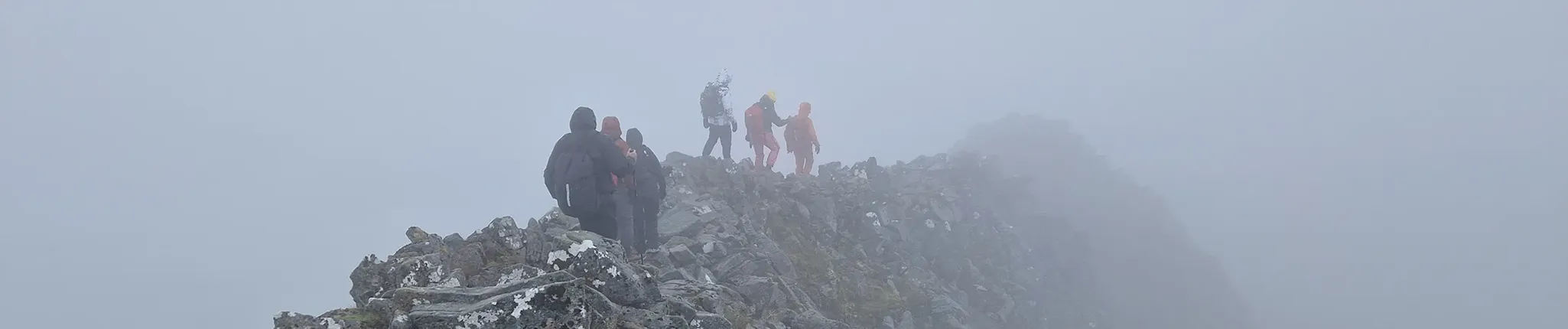
There are sections of scrambling over larger boulders along the ridge, with some impressively steep slopes on either side. Movement requires care but is not technical – just scrambling up steep steps. Some sections of the ridge are passable just below the highest rocks.

You will see remains of the observatory on the summit area (old walls) and the large stone cairn with an emergency shelter built on top. There is also a separate summit cairn with ‘Trig Point’ denoting the highest point on the mountain – 1345m! Views can be incredible from Ben Nevis on a clear day, including seeing the route you have just walked to gain the summit.
In Scotland, a cairn is a human-made pile of stones, traditionally built to mark summits, routes, or important places in the landscape. On hills and mountains, cairns often help walkers navigate in poor visibility and have long cultural roots linked to remembrance and wayfinding.
6. Retreating from the summit of Ben Nevis will take you down the Mountain Track – which is a comparatively ‘simple’ ascent, although the descent can be very tiring in itself – you are definitely only half-way through your journey and effort expenditure!
7. In poor weather, take care to navigate away from the summit plateau in a SW direction for 150m (exact grid bearing is 231 degrees) to avoid the tops of steep gullies and arrive at the three large stone cairns, which mark where the route switches to an WNW direction (exact grid-bearing is 282 degrees).
A note on checking the weather for your hike: make sure you use a reputable source – like mwis.org.uk. Many generic weather forecasts take their predictions from Fort William, where the weather may be dramatically different!
8. Following this direction for 1km, and down through the steepening of McLean’s Steep, brings you towards a cairn marking the top of the Mountain Track zig zags at 1200m.
McLean’s Steep is the steepest section of the Ben Nevis Mountain Track and is named after James McLean, who worked on the construction and upkeep of the original Pony Track in the late 19th century.
9. At this cairn, turn right to now follow the Mountain Track down to the lochan below Meall an-t Suidhe, crossing the Red Burn at apx 700m.
10. Reach an obvious junction in paths, where the Mountain Track turns left to descend to Glen Nevis.
11. To return to the North Face car park, turn right at this path junction, passing a large boulder near the path, and then take a smaller path left descending towards the outflow of Lochan Meall an-t Suidhe.
Lochan Meall an-t Suidhe translates from Scottish Gaelic to “small loch of the hill of the seat” or “resting hill”.
From this outflow point, descend vegetated (and sometimes boggy!) slopes in a NNE direction down towards the Allt a’ Mhuilinn.
12. Cross the river at apx 350m contour to re-join the engineered trail alongside the river, that descends back towards the North Face car park, as per your ascent route.
You’ll wonder if someone moved the car park further away on your return walk! But this is a grand day out in Scotland and the rewards are certainly worth your effort.
Further reading:
- Find somewhere to rest your weary legs after your hike, with our Ben Nevis accommodation guide »
- Read this fascinating article about Cairns on the scotland.com blog »
- Find out what climbing Ben Nevis is like at different times of the year »
- Make sure you’ve got the right kit: check out our Essential Kit Guide »
Ben Nevis – Your Way
We run regular guided walks on Ben Nevis, giving you the chance to join a small, friendly group led by an experienced Mountain Leader. All of our open dates are guaranteed to run, whatever the group size – take a look at our upcoming dates to find one that works for you.
If you’d prefer a more personal experience, you can also book a private guided walk. Whether you’re climbing with friends, family or colleagues, one of our Mountain Leaders can tailor the day to your group, pace and goals.
We’re also long-standing providers of charity Ben Nevis climbs, supporting individuals and groups to raise money for good causes since 2010. Over the years, our walkers have raised thousands of pounds for both local and national charities. If you’re looking to add purpose to your climb, we can connect you with one of our Charity Partners or support your fundraising for a charity of your choice.
Questions?
We’re here to help – get in touch with our team for all your Ben Nevis questions.